China Civil Aviation General Aviation Information Service Platform Launch
Upon seeing the news “First Visual Flight Chart Released in China: CAAC General Aviation Information Service Platform Online”, I immediately went online to test it and found it quite practical.
The website for the General Aviation Information Service Platform is here. You can log in using the test account “xinanceshi”.
 As seen in the screenshot above,
detailed data such as Airports, Airway segments, Waypoints, Navigation aids, Control areas, Control area sectors, Approach areas, Approach sectors,
Restricted areas, General aviation airports, Operation areas, Obstacles, and Landmarks can all be displayed.
It is truly very professional.
As seen in the screenshot above,
detailed data such as Airports, Airway segments, Waypoints, Navigation aids, Control areas, Control area sectors, Approach areas, Approach sectors,
Restricted areas, General aviation airports, Operation areas, Obstacles, and Landmarks can all be displayed.
It is truly very professional.
The website is currently still in the testing phase.
I attempted to use the user registration page to create a new account.
 However, the site did not respond at all.
It looks like we need to wait for the testing to end before all functions become available.
However, the site did not respond at all.
It looks like we need to wait for the testing to end before all functions become available.
Despite this, compared to the past, this is a huge step forward. Let us look forward to its official launch soon.
This service offers three map modes. Compared to the previous rendered images,
the Satellite Imagery mode
 or the Vector Wireframe mode looks much clearer.

Route Planning Function:
 Randomly typing in a few Waypoints and clicking to view information along the route,
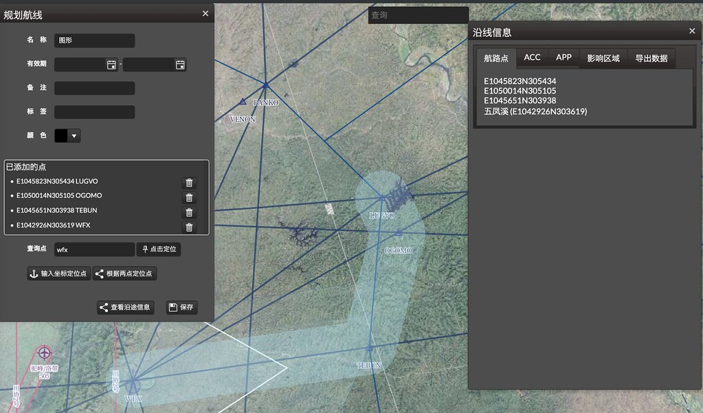 this function is actually quite practical.
Finally, here is the introduction text for the CAAC General Aviation Information Service Platform.
The first phase of the CAAC General Aviation Information Service Platform launched this time serves as the sole official channel for publishing basic information such as Visual Flight Charts and general airport data. It is available for use by military, local governments, general aviation enterprises, and general aviation airports. The platform provides users with free aviation data including visual obstacles, terrain, mountains, and rivers. It also offers functions to query transport aviation data, including Airways and routes, Transport airports, Control areas, communication frequencies, and Navigation facilities. To facilitate general aviation users, the platform also provides functions for applying for flight plans and conducting safety assessments, truly realizing a "one-stop" service.