Cumulonimbus Clouds and Supercells over Tokyo
I came to the seaside for a stroll, only to be captivated by the massive cumulonimbus clouds over Tokyo. I watched them for quite a while.
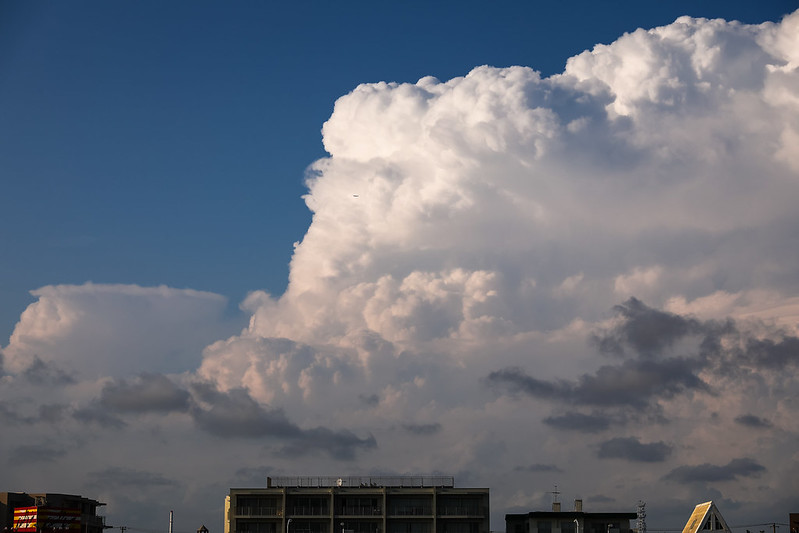 In the photo, you can see a passenger plane that has just taken off from Tokyo Haneda Airport.
I estimate the pilot must be on edge, worried about turbulence or something similar.
In the photo, you can see a passenger plane that has just taken off from Tokyo Haneda Airport.
I estimate the pilot must be on edge, worried about turbulence or something similar.
Another passenger aircraft flying near the cumulonimbus clouds.
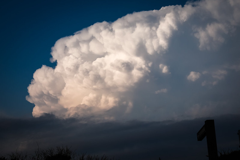
Judging by the altitude, this aircraft appears to be a transport plane that has just departed from Yokota Air Base.
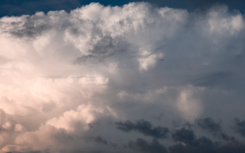 I didn’t bring a telephoto lens for my walk, only an EF24-70mm F2.8L II USM.
The aircraft are too small to see clearly, apologies for that.
I didn’t bring a telephoto lens for my walk, only an EF24-70mm F2.8L II USM.
The aircraft are too small to see clearly, apologies for that.
Such rapidly developing localized updrafts,
It is easy to associate them with a torrential storm currently happening over the Tokyo metropolitan area.
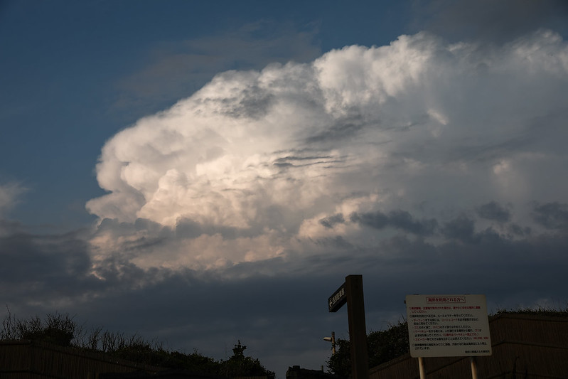
After returning home, I looked it up online, and sure enough.
Hail falling like crazy, thunder is insane too, reporting from in front of Komazawa University Station pic.twitter.com/stQWdZDhv8
— 18 (@unknown_tokyo) August 19, 2017
Then I discovered precious videos and photos taken by passengers on flights flying near the cumulonimbus clouds.
Saw a video of beautiful cumulonimbus clouds, so I thought I'd share the one I took myself (please forgive the reflections inside the cabin). Thunder is raging loudly within the clouds. Even just for the stuff that doesn't reach the ground, there's this much discharge pic.twitter.com/JQmzyXMxnx
— 朗読P, et al. (@Whitethroat) August 19, 2017
Seen before landing
— 七尾氏 (@damnxcsy) August 19, 2017
Something that looked like a cumulonimbus cloud over Tokyo pic.twitter.com/tyb1HNPpqi
Today's flight was a permanent keeper pic.twitter.com/VpaBgUmxO2
— HAL (@HAL_rebirth) August 19, 2017
Seriously a permanent save Depth Density Three-dimensional effect Light source all good pic.twitter.com/NfpXKeTgQa
— HAL (@HAL_rebirth) August 19, 2017
Especially that last photo, it is truly spectacular.
Updated August 23
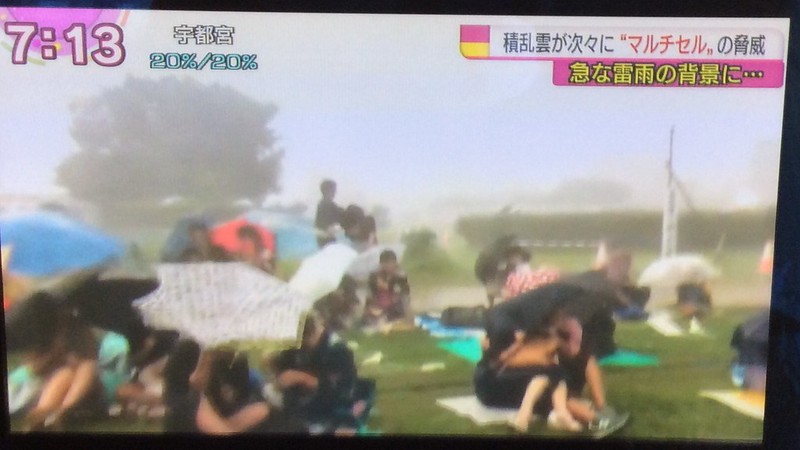
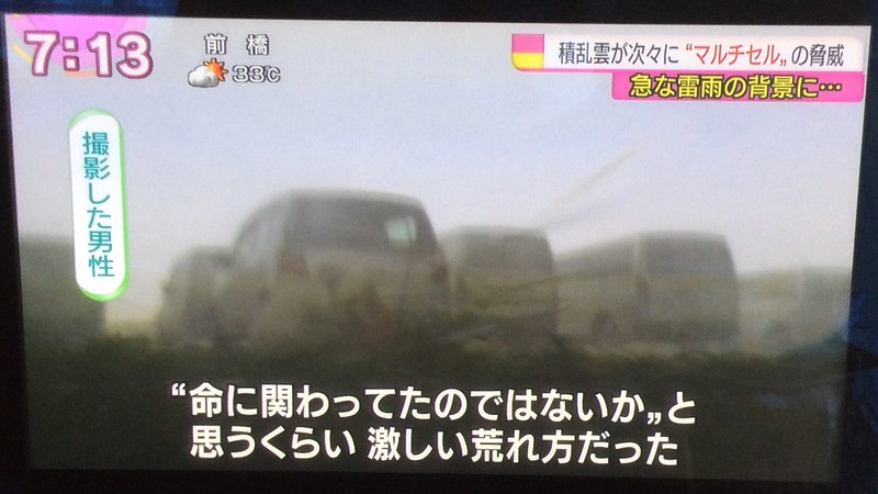
Watching the news on NHK, they also covered the weather of that day.
The cumulonimbus clouds developed into Supercells, causing some local disruption.
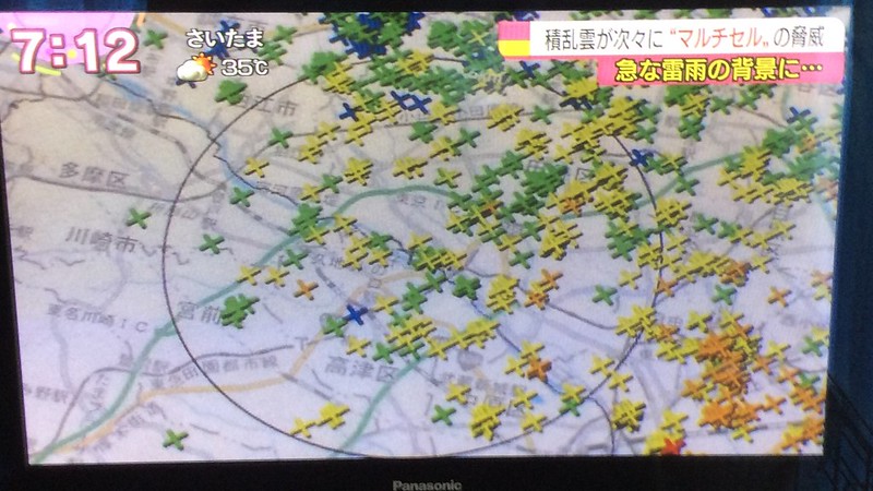
Regarding supercells, the explanation on Wikipedia is as follows:
A supercell is a type of thunderstorm (i.e., a thunderstorm) characterized by the presence of a deep, persistent rotating updraft known as a mesocyclone. For this reason, these storms are sometimes referred to as rotating thunderstorms. Of the four classifications of thunderstorms (supercell, squall line, multicell, and single-cell), supercells are the overall least common and have the potential to be the most severe. Supercells are often isolated from other thunderstorms, and they can dominate the local weather up to 32 kilometers (20 miles) away.