Boeing Uses a 787 to Draw a 787 on the Ground
Presumably for promotional purposes, Boeing used a 787 to fly a route,
drawing the outline of a 787 on the map, which looks quite like it.
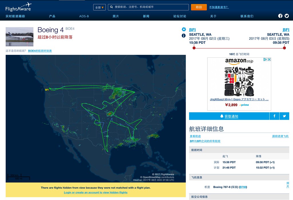
Let’s copy down the flight data:
Speed Filed: 920 km/h Altitude Filed: 10,680 m Distance Actual: 15,925 km (Planned: 25,448 km) Route SEA NORMY J70 MLP GTF 4632N/08706W 4626N/08908W 4301N/09715W 4352N/09907W 4358N/09958W 4306N/10033W 4245N/09958W 4229N/09834W 4122N/10101W 4254N/10552W 4312N/10730W 4314N/10848W 4302N/10919W 4235N/10907W 4157N/10820W 4112N/10654W 3932N/10210W 3717N/10133W 3757N/10243W 3803N/10323W 3702N/10401W 3633N/10320W 3604N/10117W 2827N/09937W 2652N/09820W 2814N/09844W 3438N/09829W 3538N/09819W 3745N/09715W 3610N/09249W 3533N/08953W 3148N/08837W 3126N/08754W 3503N/08731W 3457N/08616W 3539N/08713W 3809N/08411W 3820N/08458W 3642N/08915W 3804N/09148W 3935N/09604W 4143N/09442W 4230N/09354W 4601N/08829W 4631N/08706W
Copying this flight plan into SkyVector to take a look,
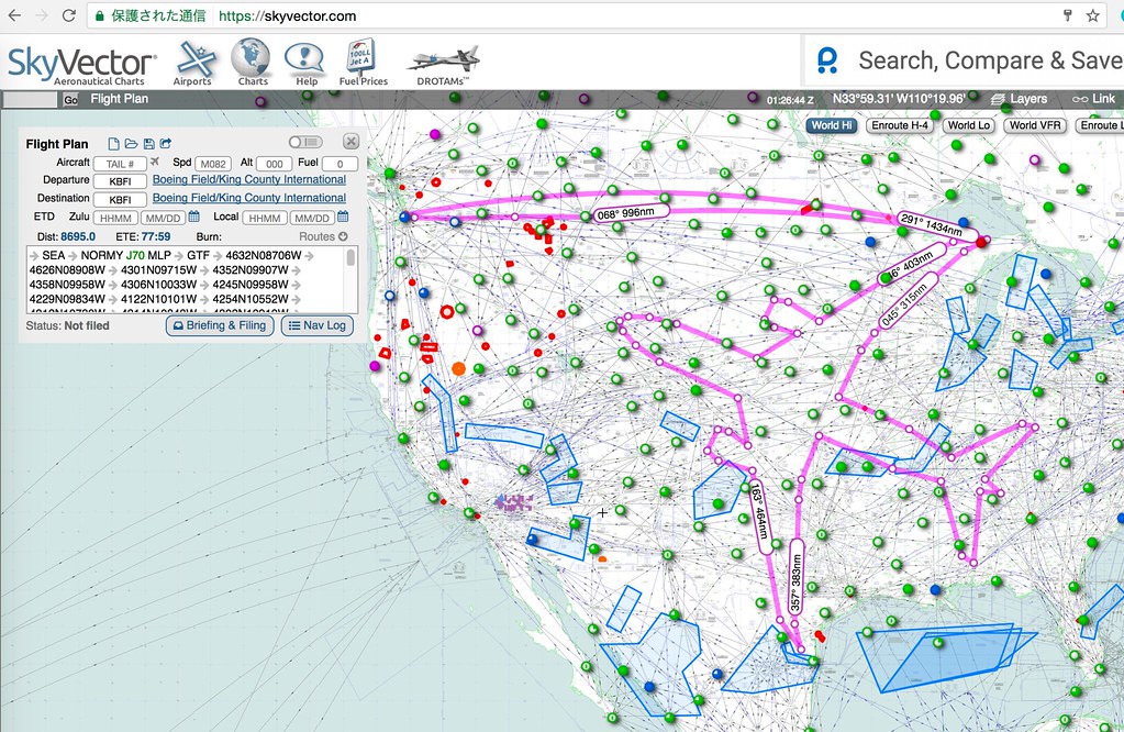 It matches the actual route, so it looks like flight simulation players can actually use this flight plan to give it a try.