All Nippon Airways Tokyo Haneda-Beijing Flight NH961 Trip Report Part 2
(Note: NH961 Flight boarding at Haneda Airport International Terminal. Haneda has 3 terminals, don’t go to the wrong one!)
Following the previous post, the flight is flying west over Tokyo.
Downtown Tokyo is right beneath our feet, and some obvious landmarks,
such as Tokyo Bay in the upper left corner, the Imperial Palace surrounded by a moat in the center left,
Tokyo Dome in the lower center, the State Guest House and Roppongi in the center,
and Meiji Jingu Shrine on the right, etc., are all clearly visible.
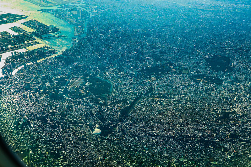
Let’s post a few more large images.
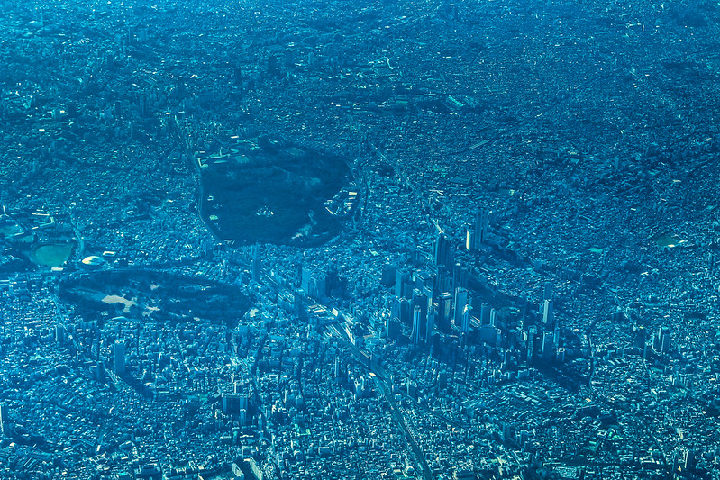
Shinjuku / Meiji Jingu / Shinjuku Gyoen area
Notice the empty space on the top left; this used to be the National Stadium,
which hosted major events like the 1964 Olympics,
and is now being rebuilt for the 2020 Tokyo Olympics.
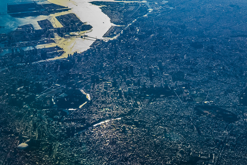
Imperial Palace / Shinbashi / Roppongi / Odaiba area
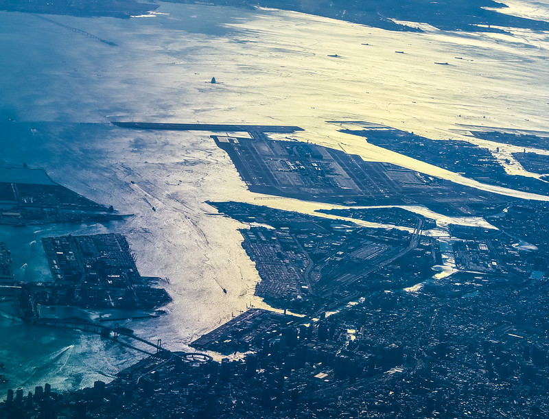
Near Chofu Airport

After this, we left Tokyo and entered Yamanashi, and the aircraft also entered the cruise phase at an altitude of 38,000 feet.
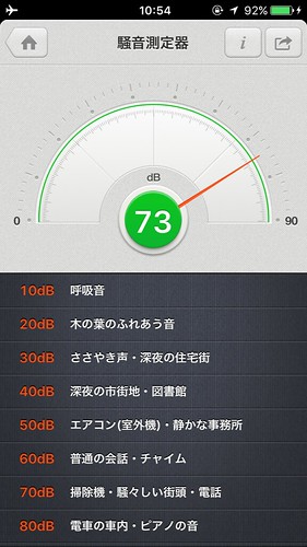
I measured the cabin noise, about 72-74 decibels, feeling about the same as the 777,
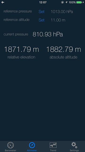
 As for air pressure, it’s roughly equivalent to the pressure at 1,800 meters, which indeed feels more comfortable than the 777’s 2,000 meters.
This is one of the 787’s great advantages.
As for air pressure, it’s roughly equivalent to the pressure at 1,800 meters, which indeed feels more comfortable than the 777’s 2,000 meters.
This is one of the 787’s great advantages.
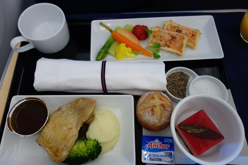
Then I had a meal,
 checked out what movies were available,
 and played around with the various flight data display modes, such as the pilot’s view, etc.
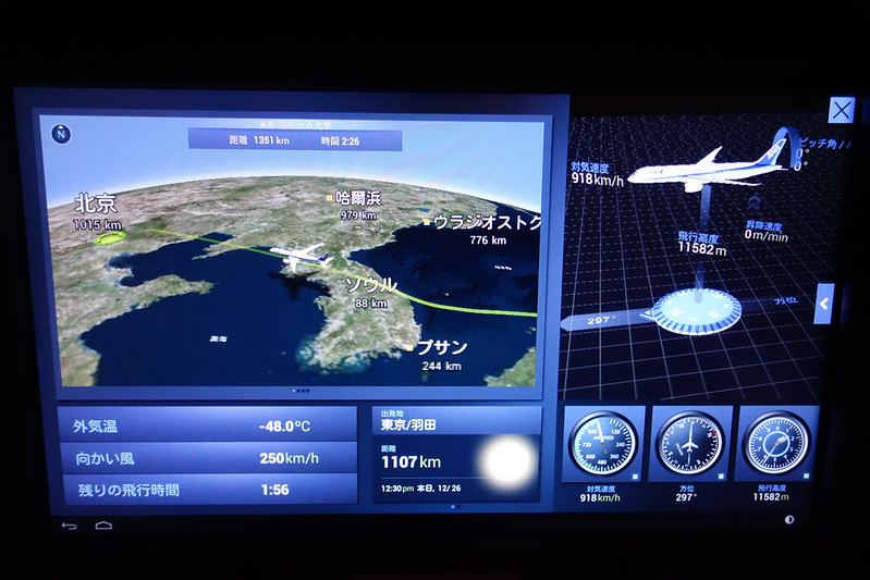
 But the best one is the mode below,
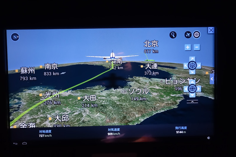
which displays the aircraft’s attitude, cruise speed, Heading, cruise altitude, outside air temperature, and wind speed all on one screen.
Due to the strong high-altitude jet stream, the ground speed was only a bit over 600 km/h.
But the best one is the mode below,
which displays the aircraft’s attitude, cruise speed, Heading, cruise altitude, outside air temperature, and wind speed all on one screen.
Due to the strong high-altitude jet stream, the ground speed was only a bit over 600 km/h.
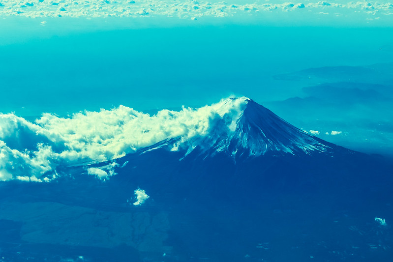
However, I spent most of the time observing the outside,毕竟 there were many landmarks to photograph.
Here are a few distinctive ones, such as Mount Fuji,

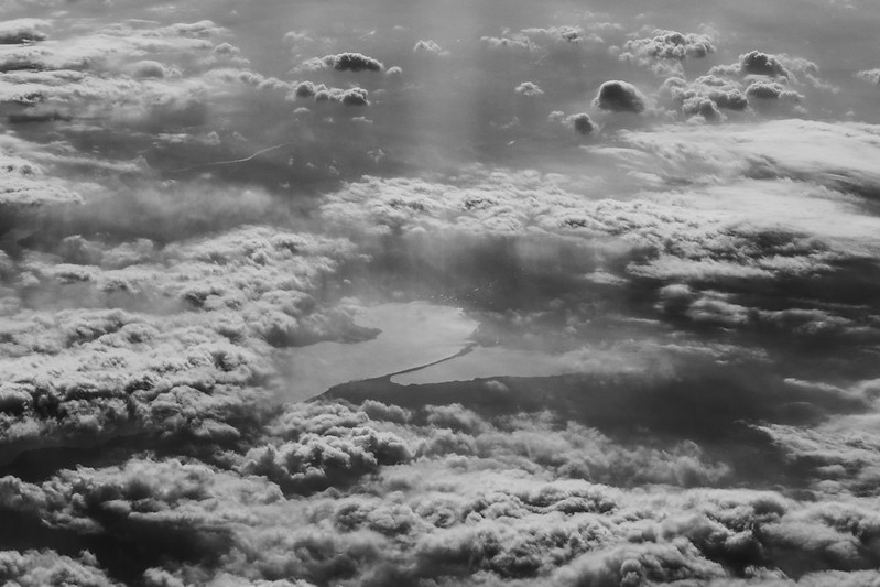
Lake Biwa

Amanohashidate, known as one of the Three Views of Japan
Near Incheon, South Korea
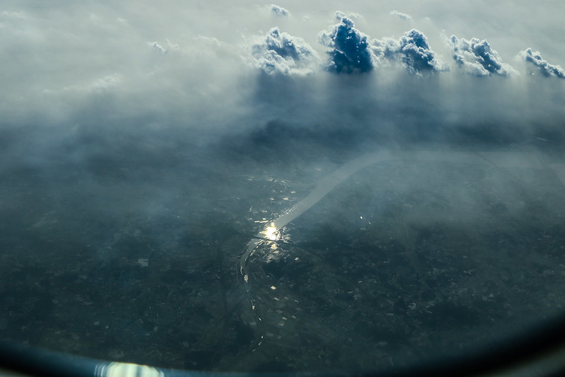
And the salt fields in Tianjin, etc.
Once past South Korea, the flight altitude immediately lowered to 30,000 feet. The headwind at this altitude is weaker,
so the ground speed increased, going from 660 km/h to over 720 km/h.
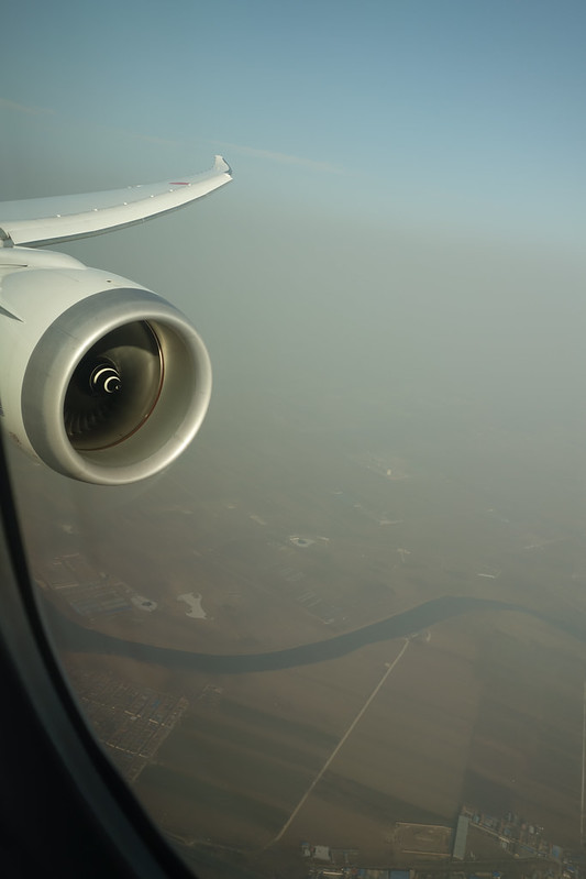
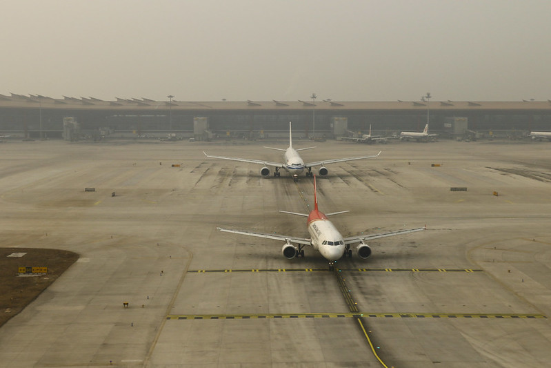
As we approached Beijing, due to air pollution, the smog phenomenon visible from the air was quite shocking,
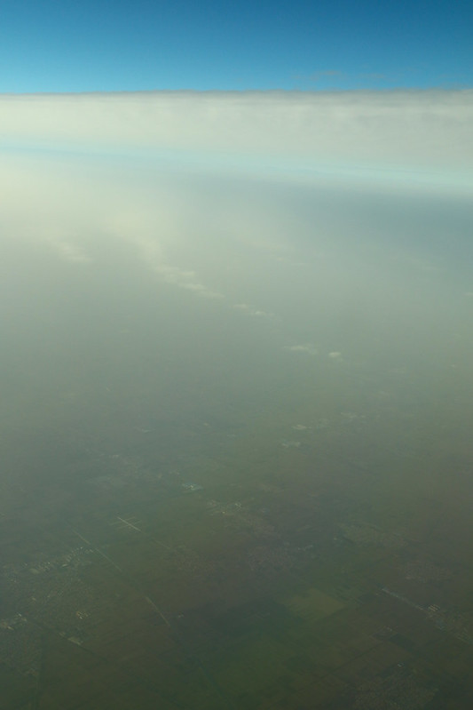 Ground targets were not only hard to identify, but the camera’s autofocus couldn’t even work properly…
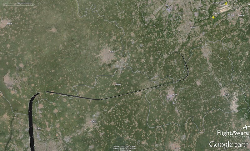
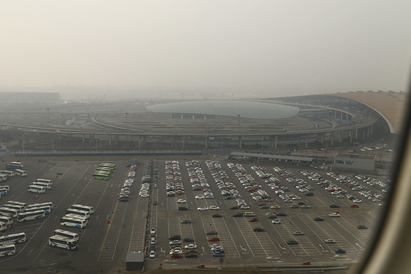
Finally, we landed smoothly, but due to Visibility issues,
without finding clear ground markers, I couldn’t determine the arrival and approach methods used.
At the time, I felt like we flew back (south) for a bit, which felt very strange.
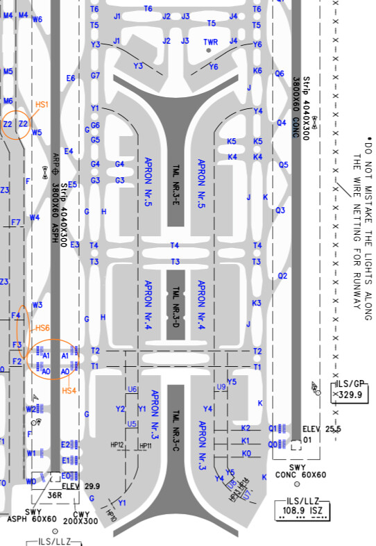
 The Runway should be 01, right?
 Because in the photo above, you can see the “K” Taxiway marking on the ground as the aircraft passes the Runway threshold.
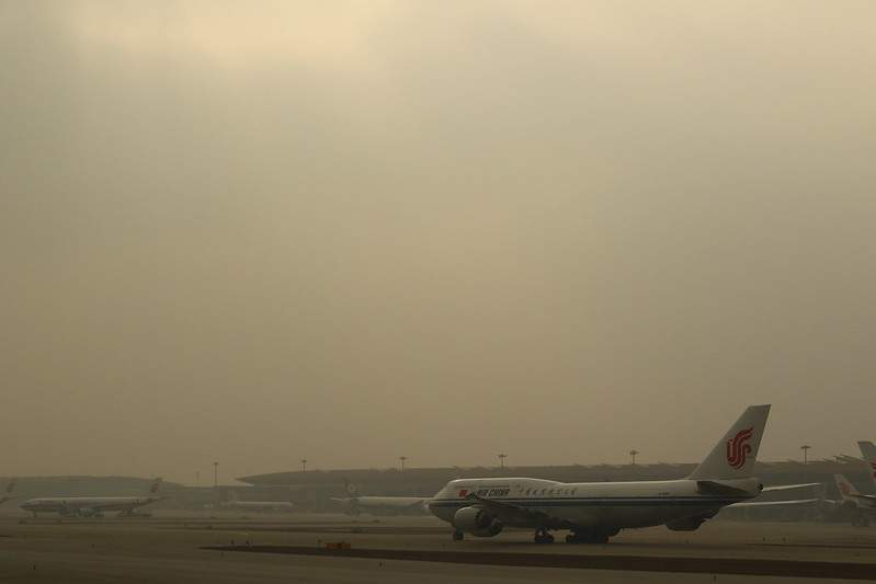 This latest Boeing 747-8, registration B-2487, looks somewhat desolate under Beijing’s smog…
Taxiing off the Runway and entering Y6, the Tower is right in front of us,
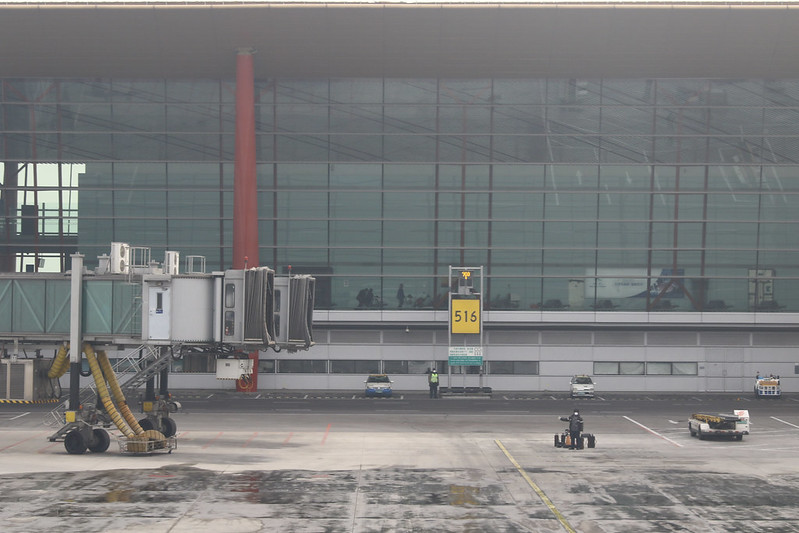
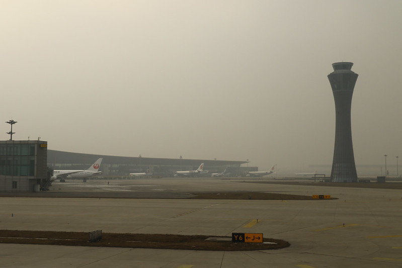 The second parking spot on the left is Gate 516 for this flight.
The ground Apron marshaller’s signals seemed to be saying — “Beijing welcomes you!”
The second parking spot on the left is Gate 516 for this flight.
The ground Apron marshaller’s signals seemed to be saying — “Beijing welcomes you!”
 Hoping Beijing’s air pollution problem will be solved soon!
The End
Later, I checked on flightaware.com and found that the approach route was indeed quite unique;
it should be radar vectors, not a standard approach:
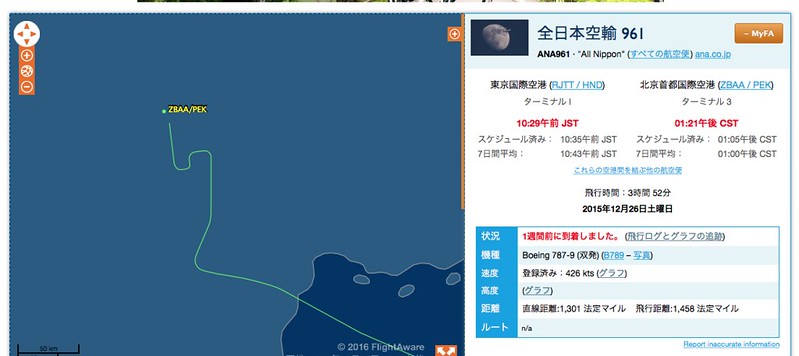
It looks like this on Google Earth, quite rare, isn’t it?