Taiwan ATC Surveillance Minimum Altitude Chart
I was quite ignorant; today, while browsing Taiwan’s AIP Electronic Flight Guide, I discovered that many airport charts include an ATC Surveillance Minimum Altitude Chart, translated as “航管监视最低高度图” (ATC Surveillance Minimum Altitude Chart). Learned something new.
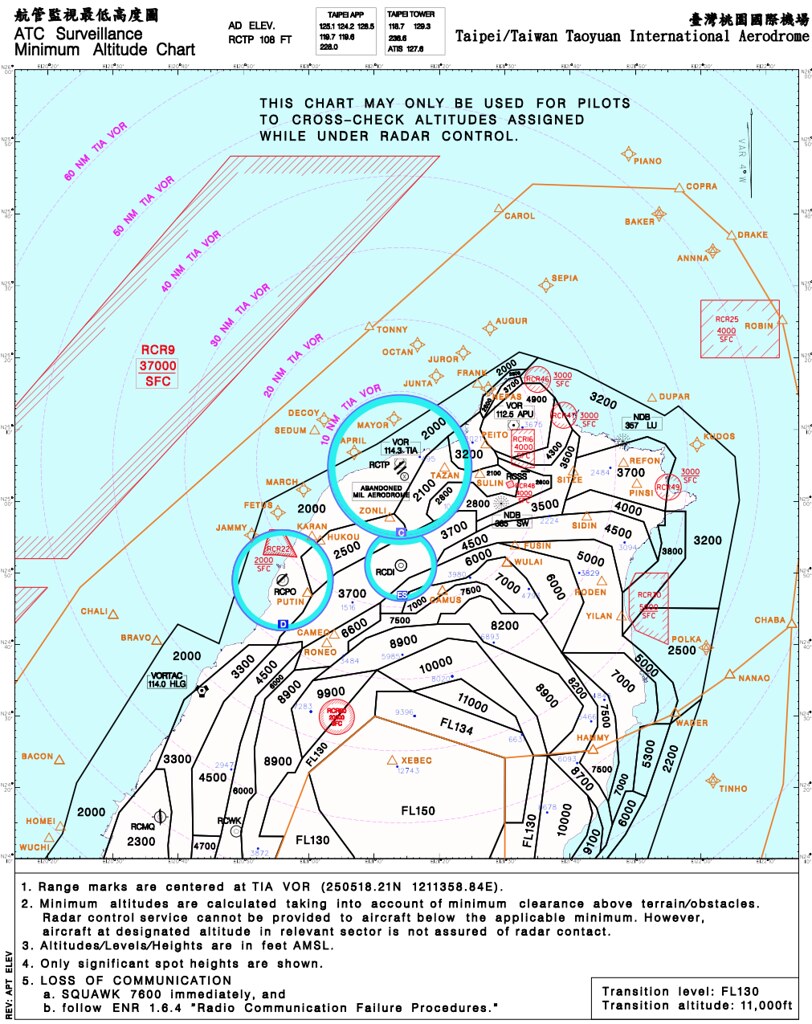
For example, Taoyuan Airport
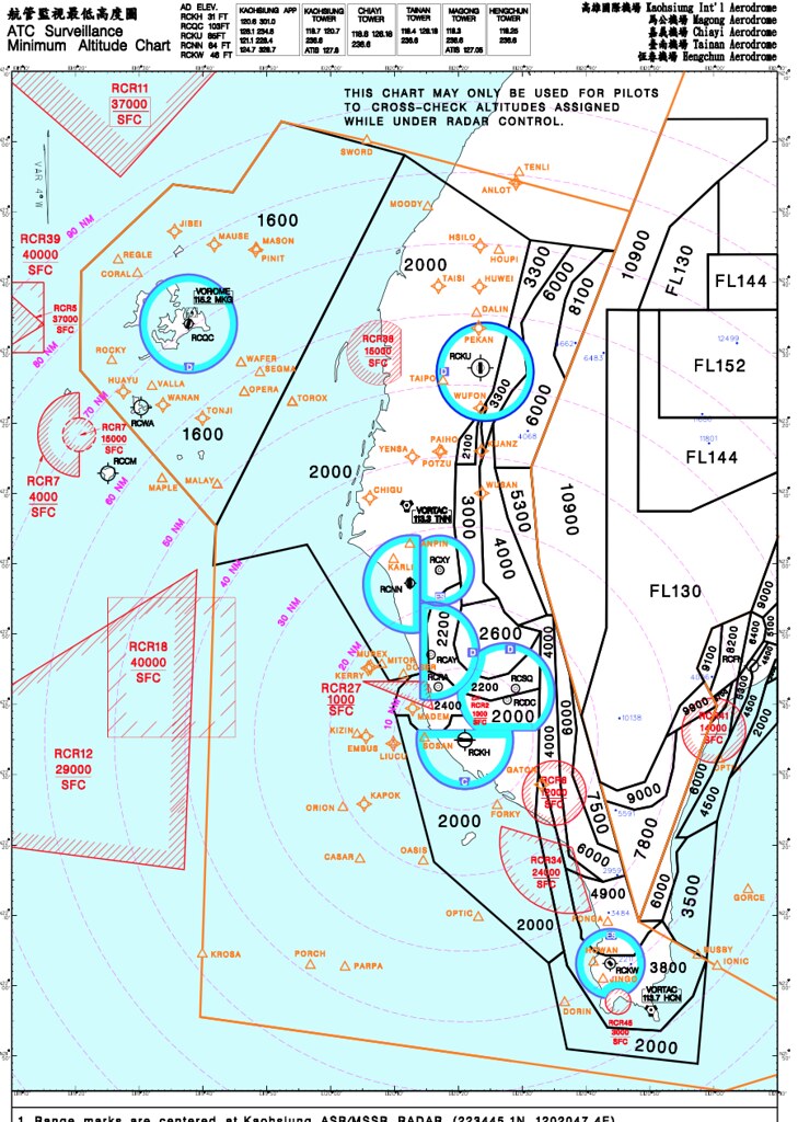
Kaohsiung Airport
 Songshan Airport
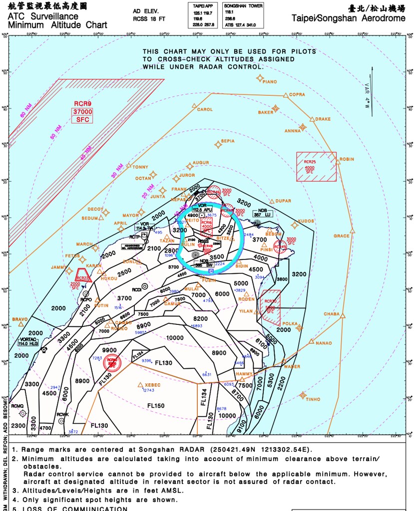
These three charts are densely packed with marked sectors; they look quite strenuous. I wonder if they are divided so finely, do pilots have enough time to monitor them effectively? I am genuinely a bit confused.
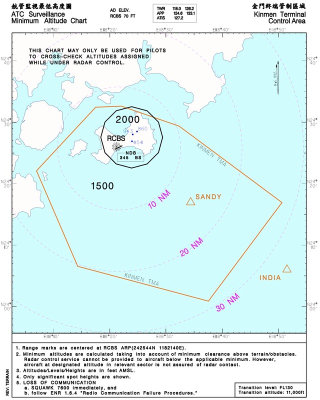
Then looking at Kinmen’s, this one seems too simple. I feel like it’s a bit of a waste to specifically separate this into its own chart…