Review of All Nippon Airways Flight NH1259 from Tokyo Haneda to Shanghai Hongqiao
It has been quite a while since I last wrote a trip report like this. Looking back, the last one was from that CX543 flight two years ago. Since last September, Japan lifted the ban on the use of electronic devices on aircraft, but since I rarely travel, the opportunity to film and document an entire flight was delayed for a long time.
For this trip (N months ago) to Shanghai, I booked ANA flight NH1259. Since it was a private trip, a relatively cheap economy seat plus a window seat was quite satisfying. Following my routine, before departure, I went to the observation deck at Haneda’s International Terminal to look at the airframe I would be riding: a Boeing 777-200ER, registration JA708A, manufactured in May 2000, serial number 28277, Spot 110.
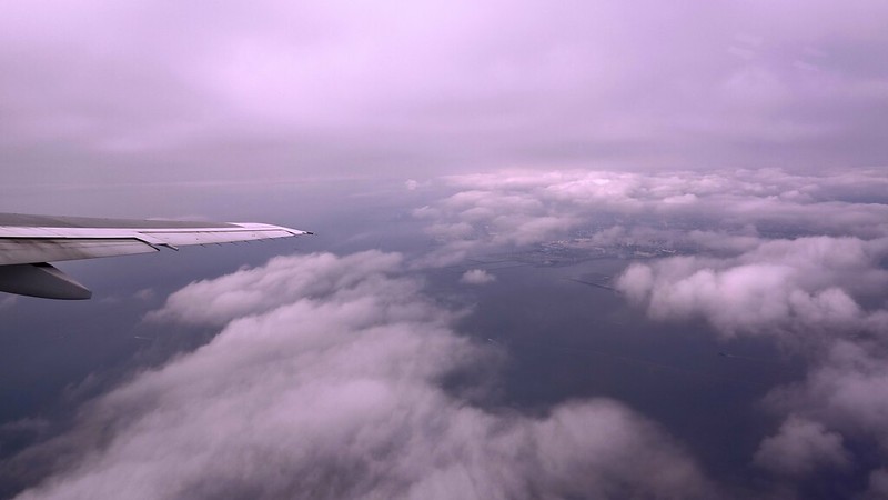
 The weather on the day wasn’t great; thick layers of stratus and cumulus clouds covered the sky.
The weather map didn’t look too bad; the low pressure had left and the high pressure hadn’t arrived yet.
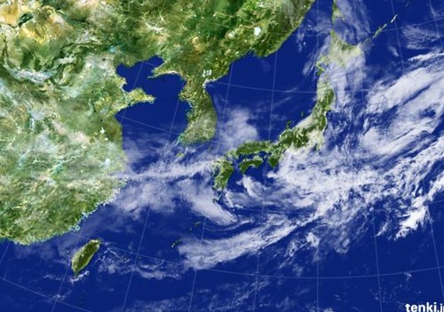
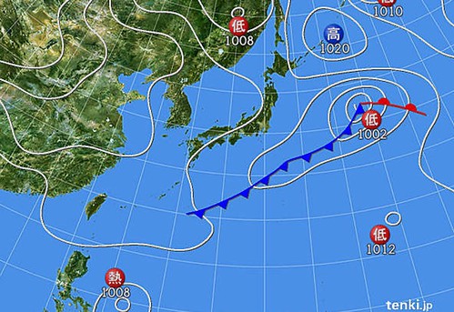 Satellite photos showed there was still a lot of cloud cover,
 So I decided to carry only a small compact camera, the RX100
, and my iPhone 6 for the flight.
After the aircraft pushed back, it stopped behind another ANA 777-300ER (JA785A) parked at Spot 109.
 Looking from my seat, I was directly behind JA785A. This shooting angle is quite rare, especially since the ground vehicles on both sides are rather symmetrical, creating a sense of balanced beauty.
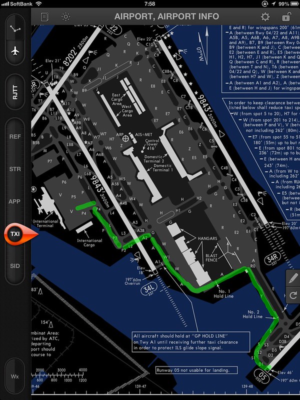
The taxi route after pushback was basically the same as the CX543 flight mentioned above: P4, P2, L2, A2, and then all the way along Taxiway A to Taxiway Y. Doors closed at 10:03, pushback at 10:07, taxi started at 10:12, reaching the threshold of Runway 05 at D1, and takeoff at 10:25, basically without stopping.
The following locations were previously no-photography zones before the electronics ban was lifted, so I am posting them one by one without hesitation.
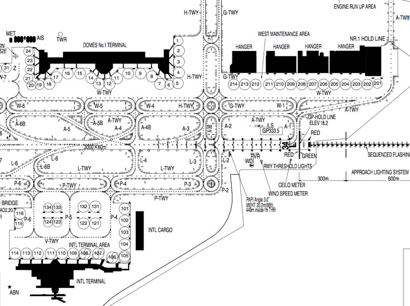
Near L2, you can see the RVR transmissometer used to measure Runway Visual Range and the Wind Speed Meter.
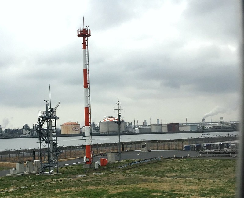 Between A2 and A1, you can see the Glide Slope (GS) antenna for the ILS on Runway 34L.
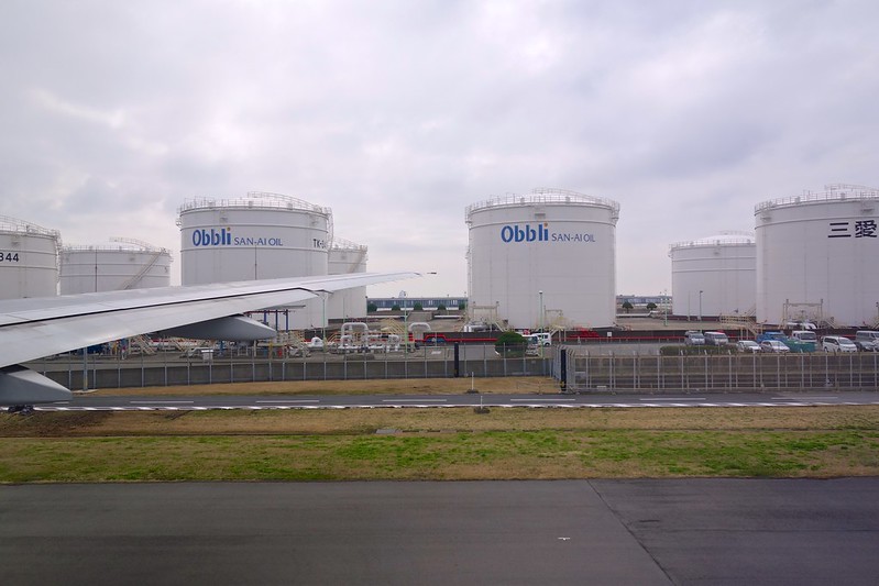
 Similarly, while moving east on Taxiway A, on the south side, you can see a dozen or so fuel storage tanks.
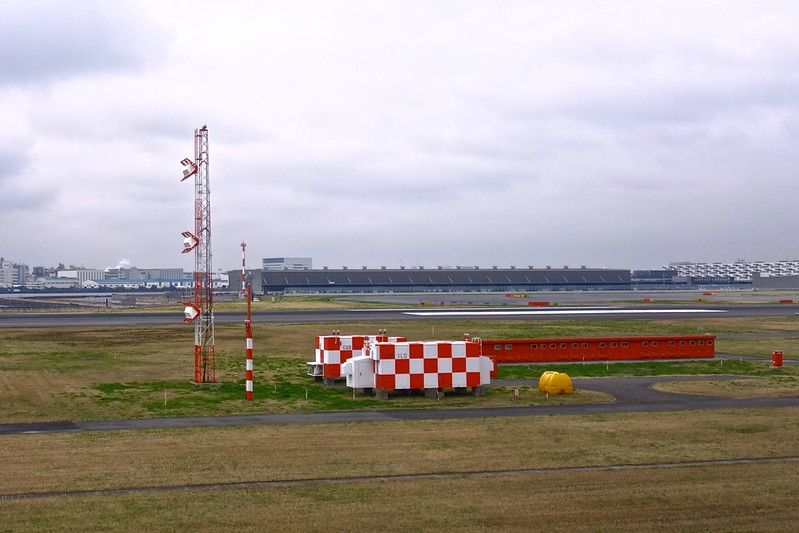
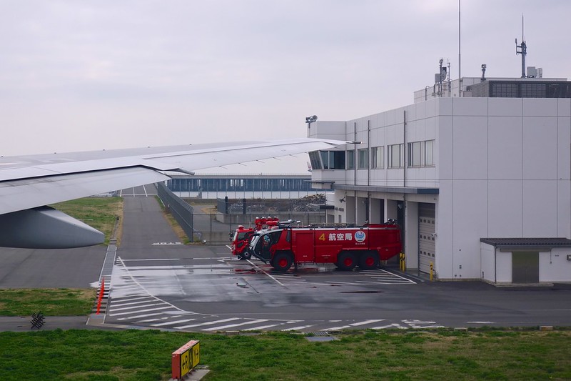
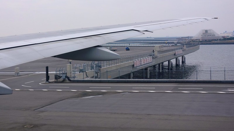
 Approaching the pier on Taxiway Y, you can also see dedicated fire trucks and the fire station.
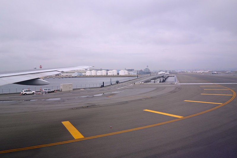
 Turning west from Taxiway Y to Taxiway S, looking north back at Haneda Airport, the pier, the fuel tanks, as well as the distant Second Terminal and Tower are all clearly visible.
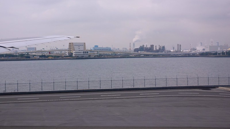
 In the middle of Taxiway S, you can see the familiar Ukishima Park on the west side. In this blog post I wrote last year, I introduced the pier structure of Haneda’s Runway D in detail.
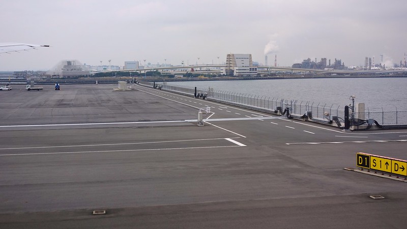
 Taxiing from S1 to D1.
 Before takeoff, taking one last look back at Ukishima Park. Hehe.
The plane turned onto Runway 05, immediately accelerated for takeoff, and then banked right, using the YANAG ONE DEPARTURE standard instrument departure procedure.
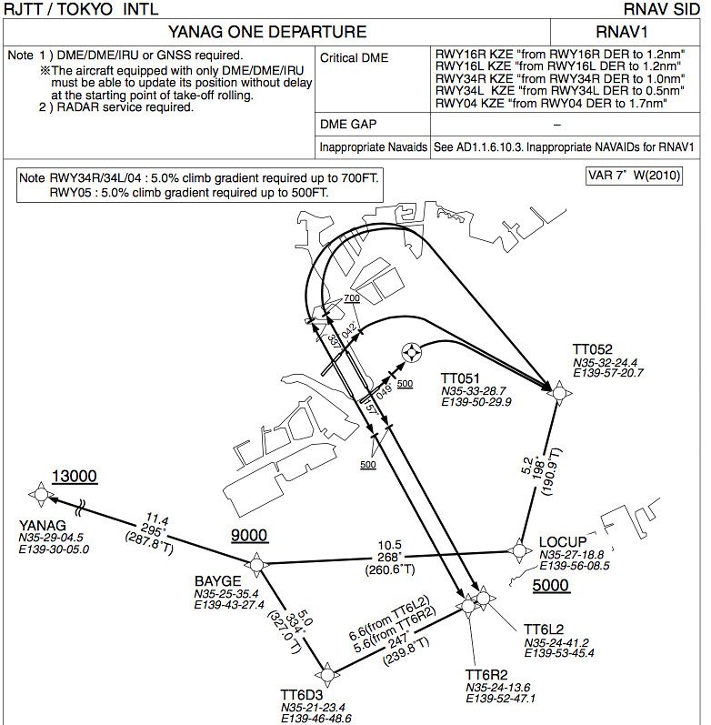 RWY05: Climb on HDG049° at or above 500FT, direct to TT051, turn right direct to TT052,
to LOCUP at or above 5000FT, to BAYGE at or above 9000FT, to YANAG at or above 13000FT.
RWY05: Climb on HDG049° at or above 500FT, direct to TT051, turn right direct to TT052,
to LOCUP at or above 5000FT, to BAYGE at or above 9000FT, to YANAG at or above 13000FT.
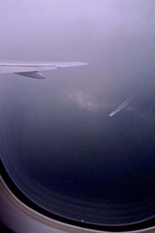
While turning from TT051 to TT052, we were still under the cloud layer, barely managing to snap a photo.
 After TT052, we flew above the cloud layer and could only “sigh at the clouds,” occasionally looking for a shooting opportunity through a gap.
 Visible in the upper right middle is the estuary of the Tama River between Runway 05 and Ukishima Park.
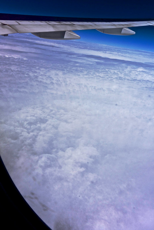
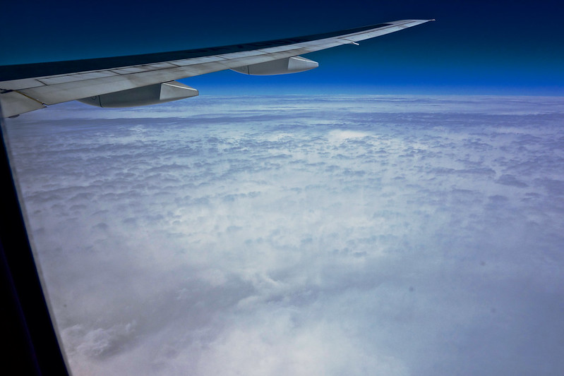
Thick high-level clouds completely obscured the ground. It was boring not being able to determine position by sight, but sometimes a blessing in disguise, because I immediately discovered a halo around the aircraft’s shadow on the clouds (a Brocken Spectre). Inside the rainbow-shaped halo at the bottom right of the photo is the aircraft I was on. Sunlight coming from behind was diffracted by the clouds, forming a rainbow-like ring around the aircraft’s shadow. Seeing this rare natural phenomenon greatly improved my mood.

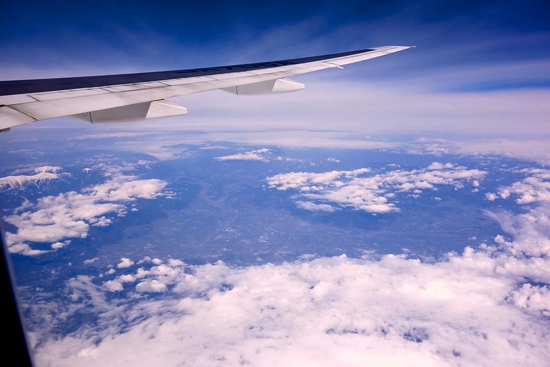
After passing the YANAG waypoint, the aircraft entered Airway Y28, which is also the standard flight plan route to southern China as stipulated in the AIP. The aircraft flew west through Tokyo, Yamanashi, Aichi, Kyoto, and Osaka, basically covered by clouds over both land and sea.
The few opportunities to photograph the ground were as follows. First is the beautiful Kofu Basin in Yamanashi. You can see cumulus clouds covering the mountains around the basin, likely convective clouds formed by updrafts from solar heating, which then circulated as downdrafts into the center of the basin, allowing for a clear shot of the ground scenery.
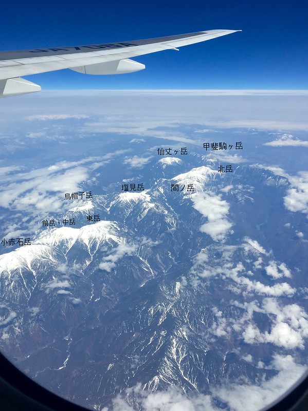
A bit later, the aircraft flew over the South Alps. The mountains here are high, and cloud cover was relatively light, so several famous peaks could be clearly identified. I have marked the mountain names on the photos for future reference.
At this point, the aircraft entered the cruise phase at a flight level of 38,000 feet (11,580 meters), with an outside temperature of -50°C. Affected by the high-speed airflow of the westerlies, the ground speed was quite slow, only around 680 km/h. One and a half hours after takeoff, the flight level increased to 40,000 feet (12,190 meters), but the speed didn’t improve much.
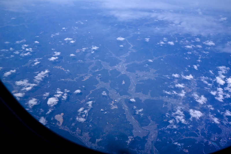
Below is Shisō, Hyōgo Prefecture. It is a small town in a hilly area, but the terrain is quite interesting and relatively easy to identify.
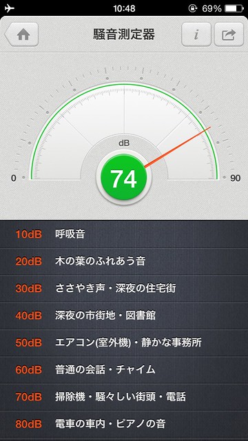
It was boring with so many clouds, so I tested the noise level and found it was only 74 decibels. It was surprisingly not too loud inside the plane, actually lower than the commuting subway.
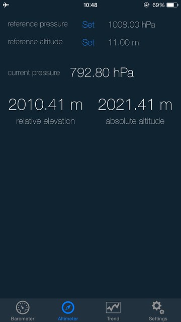
 I also checked the pressure. After cabin pressurization, it was 792.8 hPa, equivalent to an altitude of 2,000 meters. This was as expected.
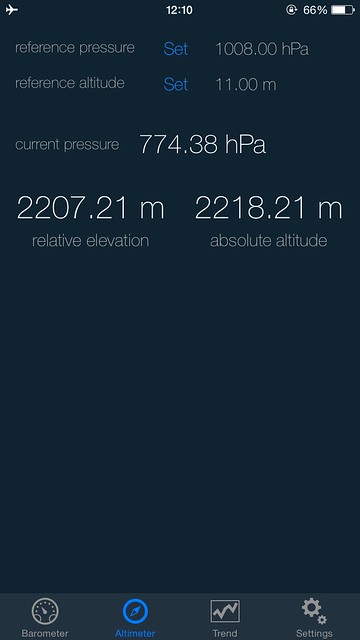
 After climbing to 40,000 feet, I measured the pressure again and found it had depressurized to 774 hPa, equivalent to an altitude of 2,200 meters.
After flying out to sea, the cloud layer became even thicker, but sometimes this kind of collapsing high-altitude stratus would appear.
 It looked very spectacular. You could imagine there was relatively strong vertical airflow blowing the stratus clouds into these streak shapes.
 I guessed that turbulence would occur, and sure enough, the seatbelt sign lit up. Light to moderate turbulence (physically felt like LIGHT+ to MOD) lasted for nearly 10 minutes before stopping.
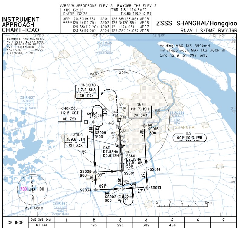
From Haneda to Hongqiao, the regulation specifies the use of Airway A593 to the PUD VOR, followed by a standard arrival procedure (which should have been PUD-3F that day). However, it was cloudy the whole way, so no ground markings were visible. Breaking out of the clouds and seeing the ground happened about a minute before landing. According to the map on board,
 landing was on Runway 36R. The route basically matches the approach chart below. The IAF (Initial Approach Fix) is at SS015 at 1800 meters, flying south to SS013 then turning west to SS002 at 900 meters, then turning north and descending via ILS. The photo above shows an altitude of 609 meters, so the position should be between SS002 and SS001.
Approaching the airport, I could finally see the ground. This highway should be the G50 Shanghai-Chongqing Expressway outside the airport.
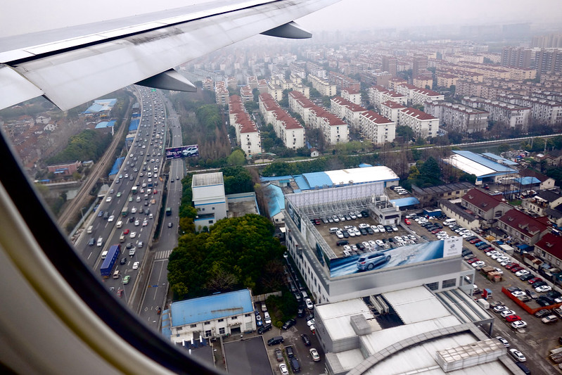
It was my first time at Hongqiao Airport, so everything was unfamiliar. I guessed the building on the right was Terminal 1.
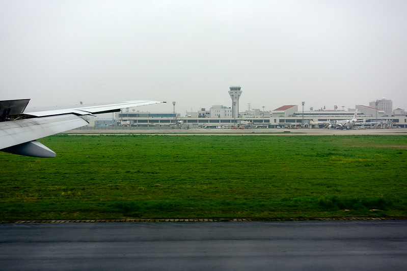 The aircraft exited the runway at A2, taxied along Taxiway A via K4 to the K5 exit, and entered the Apron.
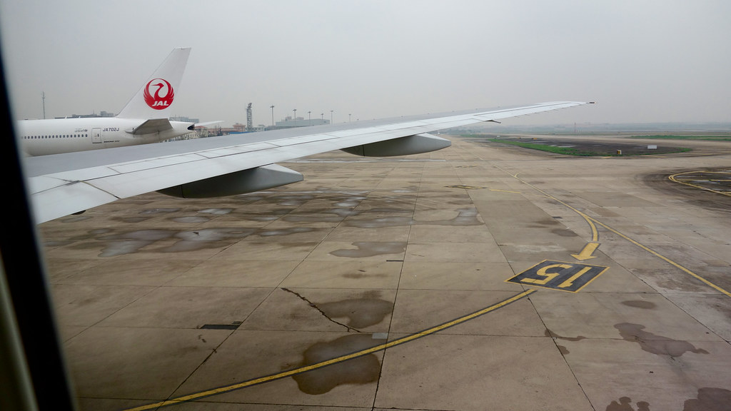
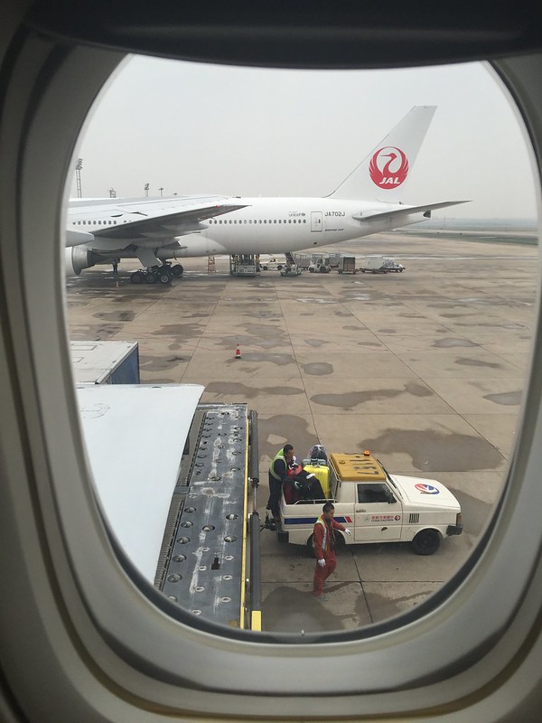
 Finally, it turned into Spot 15.
As soon as the plane stopped, the luggage cart arrived. It looked like the ground staff were quite efficient.
Terminal 1 is very small with few flights. Immigration and baggage claim were very fast. I was out before I could even carefully observe the terminal’s interior facilities. I will look for another opportunity in the future.
Flight Route for this trip: RJTT LOCUP BAYGE YANAG TANZA KOGEN ENNAR KOMAK CUE SANDA HYOGO ASANO OLIVE BIZEN PIONE DANGO WASYU BAMBO ONDOC IWC CLIPA ASARI DGC FUE POTET ONIKU LAMEN AKARA PUD ZSSS
(The A593 airway section from ONIKU to LAMEN originally belonged to Incheon FIR’s management, but since 2003, for efficiency, China-Japan routes should be directly handed off between Fukuoka and Shanghai FIRs.)
End