ATC Surveillance Minimum Altitude Chart
Reading the AIP (Aeronautical Information Publication) out of boredom, I noticed a new type of chart added in the China Civil Aviation eAIP — the ATC Surveillance Minimum Altitude Chart. Since this was a new piece of knowledge for me, I decided to look it up.
Here is the ICAO explanation for the ATC Surveillance Minimum Altitude Chart:
This supplementary chart must provide information which will enable flight crews to monitor and cross-check altitudes assigned while under radar control by a controller using an ATS surveillance system.
In other words, this is used by flight crews under radar guidance to cross-check and monitor the minimum altitudes for various radar guidance areas and sectors.
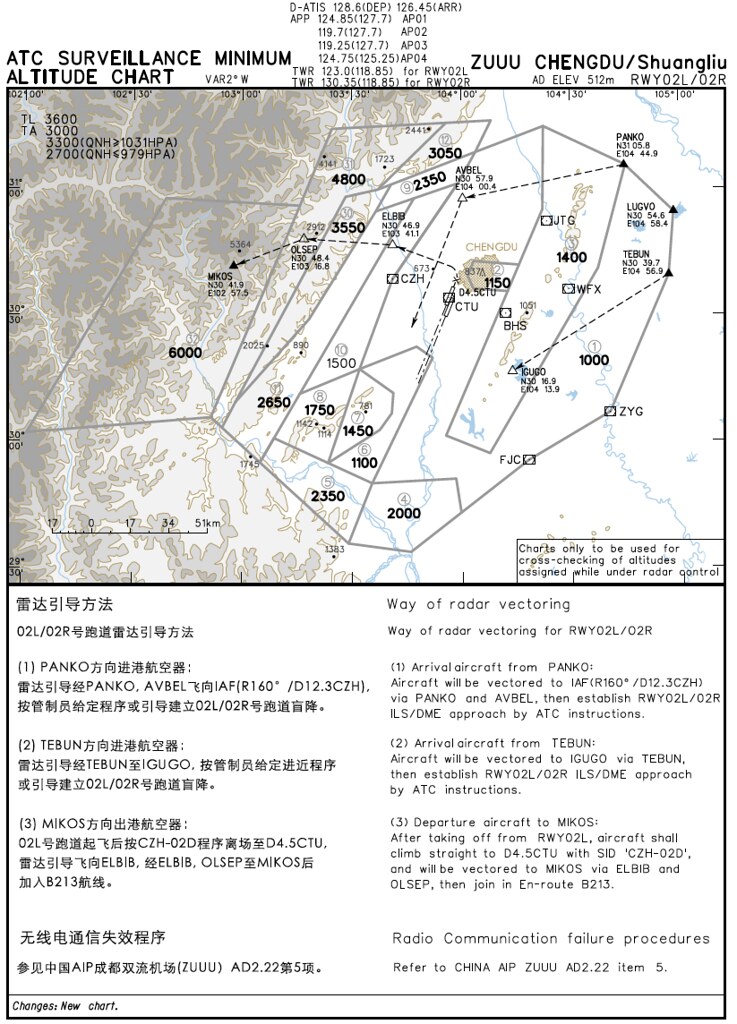
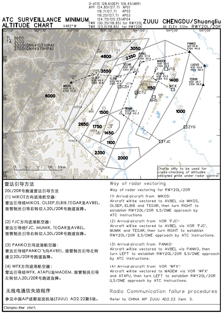
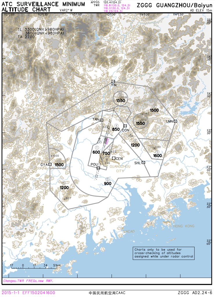
Currently, the ATC Surveillance Minimum Altitude Charts published by China Civil Aviation include only three charts: two for Chengdu Shuangliu Airport (Runways 02L/02R and 20L/20R), and one for Guangzhou/Baiyun Airport.
The charts look quite intuitive. Dashed lines indicate the schematic routes during radar guidance. Combining this with the minimum radar vectoring altitude for each sector allows the flight crew to have a clear understanding of safe obstacle clearance margins.
1 Chengdu/Shuangliu ZUUU AD2.24-6A ATCSMAC RWY02L/02R
2 Chengdu/Shuangliu ZUUU AD2.24-6B ATCSMAC RWY20L/20R
3 Guangzhou/Baiyun ZGGG
End