Revisiting Airport Weather Information in Adverse Conditions (Continued)
Following the previous post, I checked the weather at several airports again this morning. Although the pressure wasn’t as low as I had imagined, it was still windy and snowy, so let’s record it.
First, I have to mention the news about an American Airlines flight AA280 (from South Korea to Dallas, USA) encountering Turbulence over Japan last night and having to Divert to Narita in the middle of the night. Apparently, over a dozen passengers and crew were injured.
EMERGENCY #AA280: Multiple injuries as massive turbulence forces emergency landing in Japan https://t.co/RTJ28pIX8E
pic.twitter.com/3VSC040yb4
— AirLive.net (@airlivenet) December 17, 2014#AA280 left Japanese coast 5h ago so turbulence must have occurred far from land https://t.co/3gSH0wibo7 pic.twitter.com/09qjO32WRJ
— Flightradar24 (@flightradar24) December 16, 2014You can see from the video below just how severe the Turbulence caused by this low-pressure system was:
Next, let’s look at the weather.
 Here at Haneda, there was also a Turbulence report from an Airbus A330-300, located 15 nautical miles south of Haneda Airport, at an altitude between 9,000 and 12,000 feet.
 Toyama Airport has low Visibility, with light thunderstorms and snow, and weak thunderstorms above, moving towards the northeast.
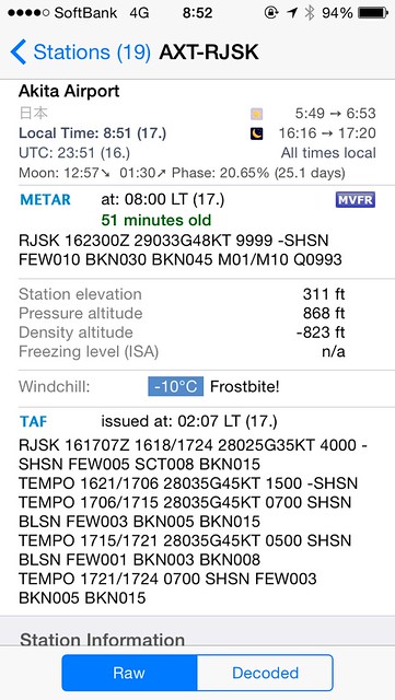 Akita Airport has high wind speeds, reaching a maximum of 44 knots, with snow showers.
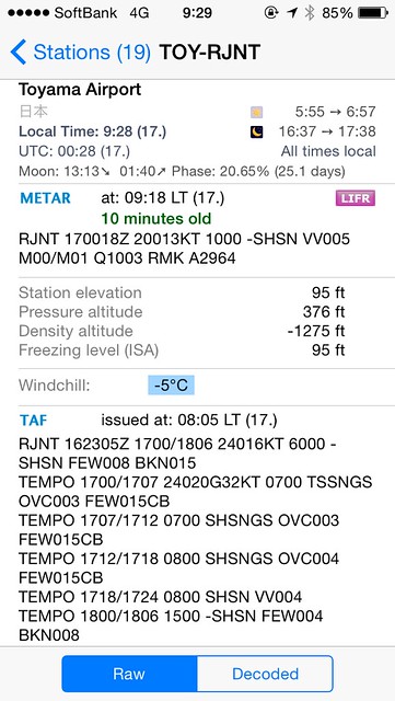 Toyama Airport nearly an hour later, Visibility is even lower, the vertical Visibility is only 500 feet. The TAF indicates that winds will be stronger later, along with weather conditions like graupel and cumulonimbus clouds.
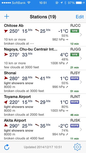 It's too tiring to look at them one by one, so let's list several airports and view them together.