Review of Cathay Pacific Flight CX543: Haneda to Hong Kong
One morning, I took Cathay Pacific Flight 543 to Hong Kong. Sitting in the rear left seat, I had great weather and took plenty of photos along the way, so let me share the experience here.
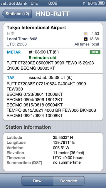
The weather on the day was few clouds and no wind at Haneda, with visibility over 10 km—perfect for travel.
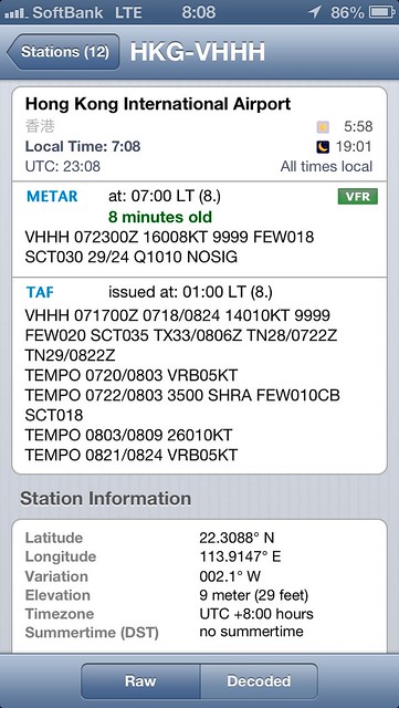
 The weather at Hong Kong airport was quite similar, just with slightly more cloud cover. Lucky me.
 I also checked the high-level weather chart; there were no adverse conditions like strong winds.
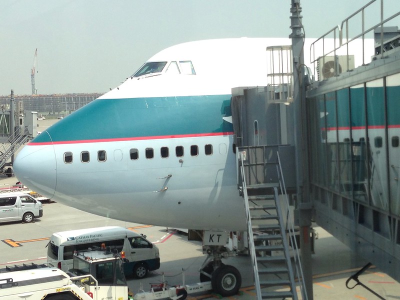
Before departure, following my routine, I went to the airport observation deck to watch planes. The flight for this trip used a Boeing 747-400 airframe,
 Model 747-412, registration B-HKT, manufacturer’s serial number 27132/955. It turns out this is an old bird that rolled off the assembly line in 1993.
This airframe first served with Singapore Airlines for 12 years, was sold to El Al in 2005, and then acquired by Cathay Pacific in 2007 where it underwent modifications, so the onboard equipment is quite advanced. It’s been a while since I flew on a 747, so this was a good refresher.
Model 747-412, registration B-HKT, manufacturer’s serial number 27132/955. It turns out this is an old bird that rolled off the assembly line in 1993.
This airframe first served with Singapore Airlines for 12 years, was sold to El Al in 2005, and then acquired by Cathay Pacific in 2007 where it underwent modifications, so the onboard equipment is quite advanced. It’s been a while since I flew on a 747, so this was a good refresher.
Then it was through customs and check-in. Everything went smoothly, boarding was on time, and I took another close-up shot before getting on the plane.
 The in-flight entertainment system screen is about 7 inches—pretty big actually.
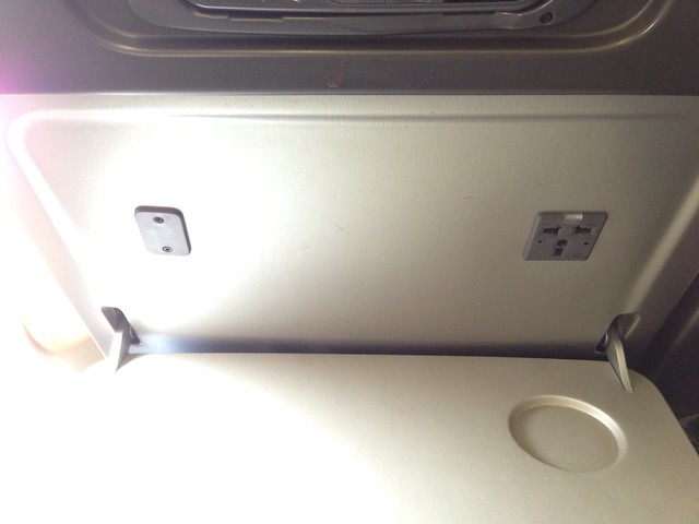
 Opening the tray table, I discovered a power outlet hidden inside. No need to worry about my phone battery dying now.
Based on the weather, I guessed we would use Runway 05 for takeoff, and sure enough,
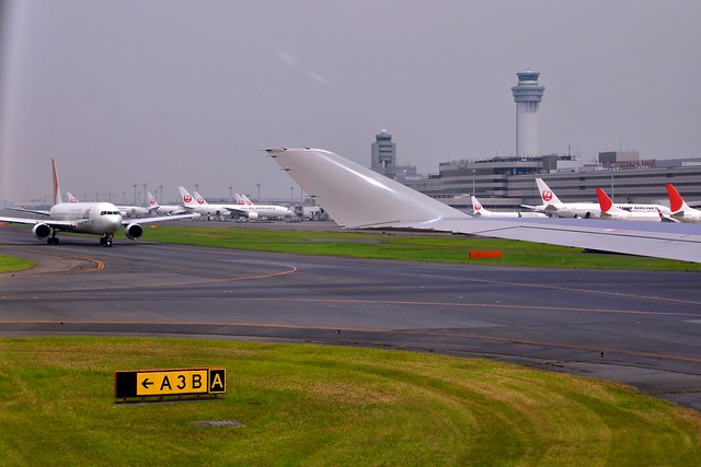
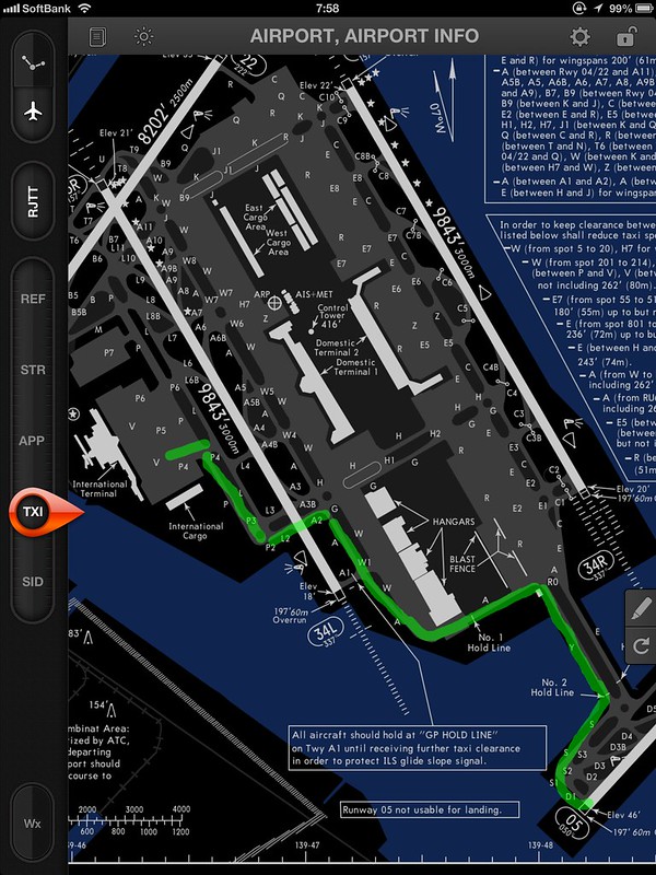
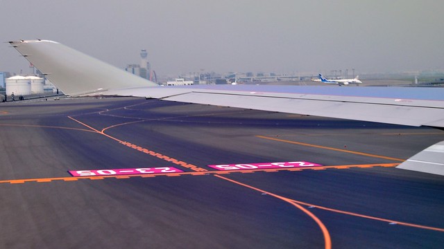 After pushback, we taxied via Taxiway P2, A2, A, Y, S, and S1 to the threshold of Runway 05.
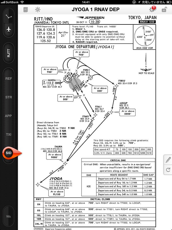
Mapped out on the Jeppesen charts iPad app, it looks like this:
After pushback, we taxied via Taxiway P2, A2, A, Y, S, and S1 to the threshold of Runway 05.
Mapped out on the Jeppesen charts iPad app, it looks like this:
After takeoff, I visually estimated the departure as the JYOGA 1 RNAV procedure (though I’m not entirely sure),
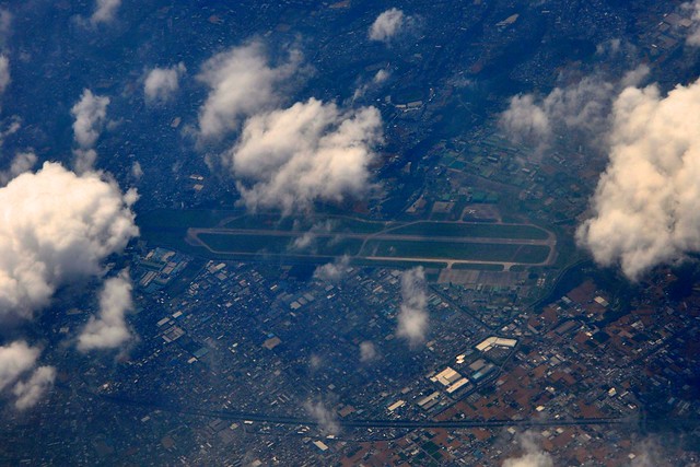
 We turned over Tokyo Bay, flying over the Kisarazu Base (RJTK),
 Crossing the Miura Peninsula, we headed west along airway Y56 over Sagami Bay, passed the Izu Peninsula, and entered the airspace over Shizuoka.
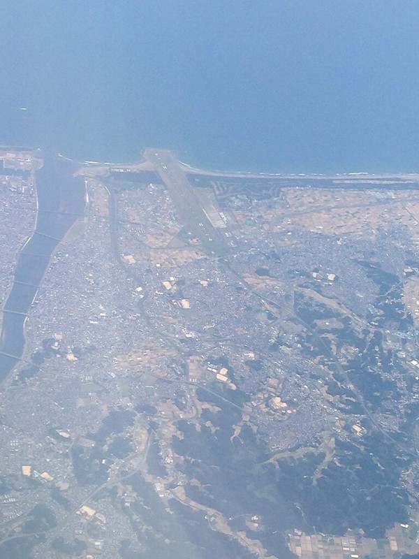
Although there was some cumulus cloud, I could still clearly see the runway of Hamamatsu Base (RJNH).
Crossing the Miura Peninsula, we headed west along airway Y56 over Sagami Bay, passed the Izu Peninsula, and entered the airspace over Shizuoka.
Although there was some cumulus cloud, I could still clearly see the runway of Hamamatsu Base (RJNH).
Then we entered airway Y24 (A1) at the southernmost tip of the Kii Peninsula. After passing below the island of Shikoku, we cut diagonally across Kyushu over Kagoshima Bay, heading straight for the island of Taiwan.
 The photo above shows Miyazaki Airport (RJFM).
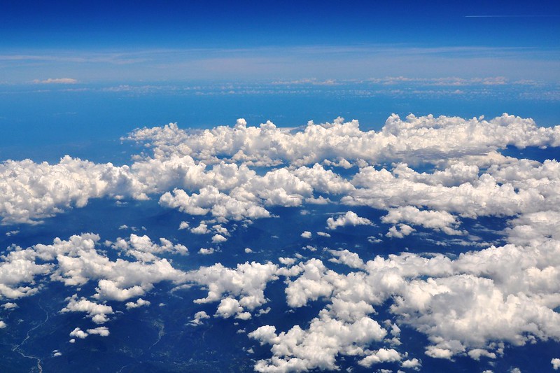
The weather was sunny throughout the journey. The thin cirrus clouds high above made the sky look even bluer, while clusters of white cumulus clouds dotted the low-altitude landscape.
 The leg from Shikoku to Kyushu had slight Turbulence. With a cruising altitude of 36,000 feet, the shaking wasn’t severe, so the pilot didn’t change the flight altitude.
The flight over the Pacific was relatively smooth. There were more cumulus clouds, and the scenery was breathtaking.
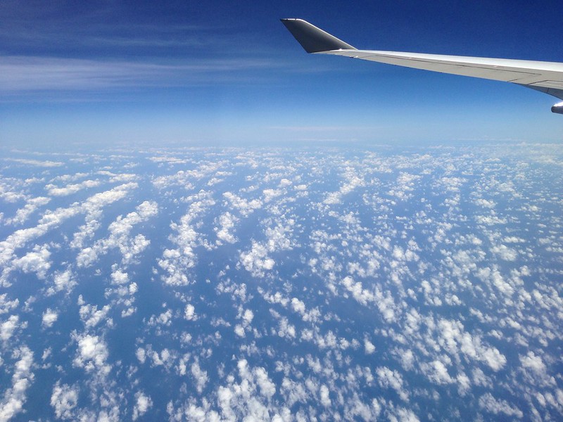 The cirrus clouds, thin as silk, made you want to reach out and touch them.

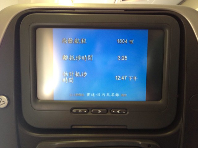
Flight data during Cruise: Altitude 36,000 feet (10,972 meters) Ground Speed 604 knots (972 km/h)
2 hours and 20 minutes after takeoff, the aircraft reached the skies above Taipei. Taipei Songshan Airport (RCSS) and the Taipei city area were clearly distinguishable.
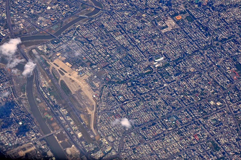 The arena in the middle right of the photo is the “Taipei Arena”, and in the upper right corner is the Sun Yat-sen Memorial Hall.
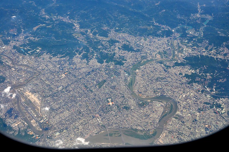
Here’s a panoramic view of Taipei. The square area in the lower middle of the photo is the Chiang Kai-shek Memorial Hall. (Thanks to Justin Choi for the correction)
The arena in the middle right of the photo is the “Taipei Arena”, and in the upper right corner is the Sun Yat-sen Memorial Hall.
Here’s a panoramic view of Taipei. The square area in the lower middle of the photo is the Chiang Kai-shek Memorial Hall. (Thanks to Justin Choi for the correction)
That day, the amount of cumulus cloud over the island of Taiwan was high and the cloud tops were very tall; the convective updrafts looked significant.
Later we passed Taichung Qingchuan Airport (RCMQ),
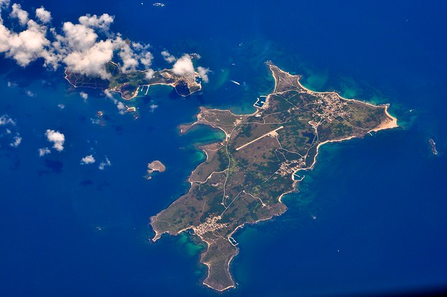
 And Wang’an Airport (RCWA) on Wang’an Island, a small island in the sea—Penghu,
 The beautiful island of Taiwan is truly magnificent.
After flying for nearly another 40 minutes, the aircraft’s altitude continuously decreased as we began the arrival and approach procedures.
I have zero confidence here, but was the arrival this one?
Starting from ELATO, located between Taiwan and Hong Kong, descending to FL260 at MAGOG, and down to 10,000 feet at ABBEY. It’s possible.
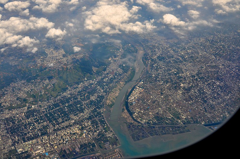
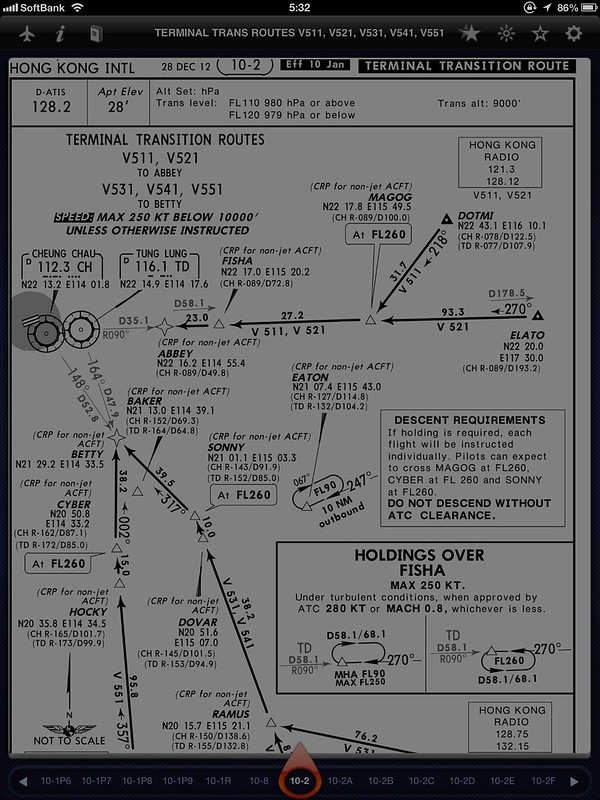 However, we might have been held at ABBEY and entered a holding procedure circling once, because I noticed that the Pinghai Bay and Daxingshan in Gangkou Town captured in this photo are directly above ABBEY, and the flight direction at that time was east.
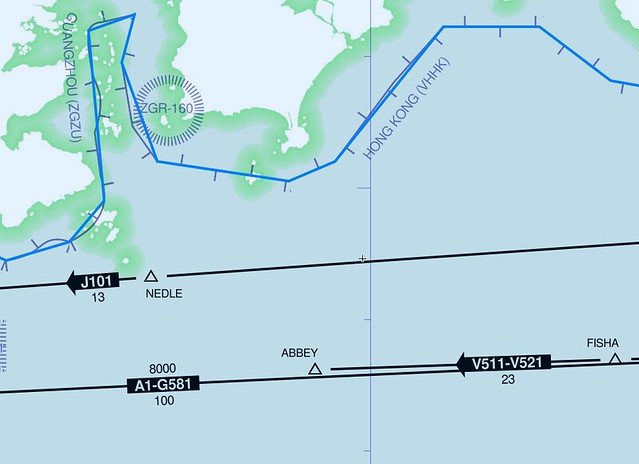
Based on the distance, it’s also possible we used airway J101 and were held at waypoint NEDLE, though that seems less likely.
However, we might have been held at ABBEY and entered a holding procedure circling once, because I noticed that the Pinghai Bay and Daxingshan in Gangkou Town captured in this photo are directly above ABBEY, and the flight direction at that time was east.
Based on the distance, it’s also possible we used airway J101 and were held at waypoint NEDLE, though that seems less likely.

The approach was likely this RNAV RWY 25R, though I’m not confident about the segment from ABBEY to RIVER.
It feels like we didn’t come in a straight line from HAMOK to avoid the high cumulus clouds.

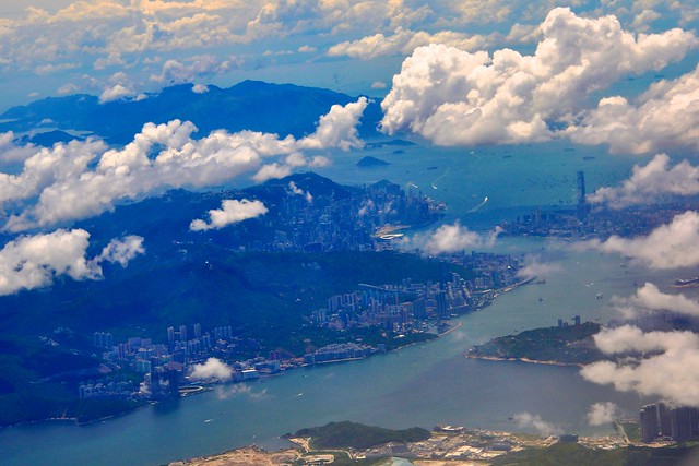
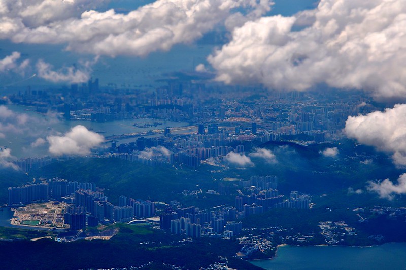
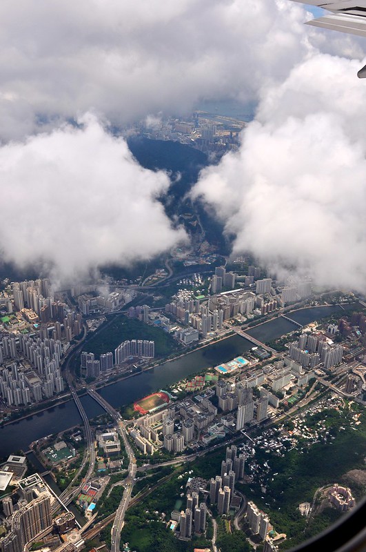
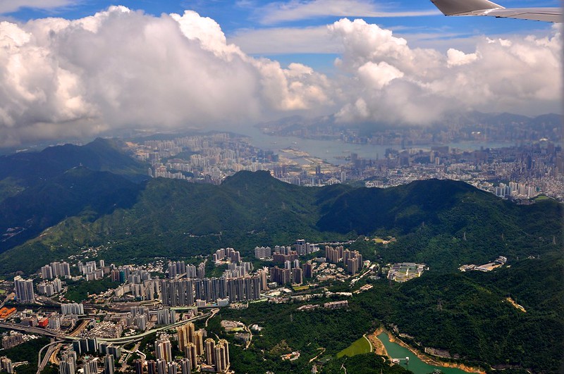
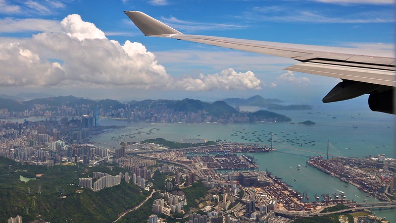
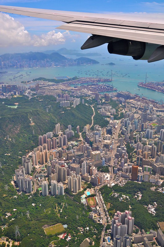
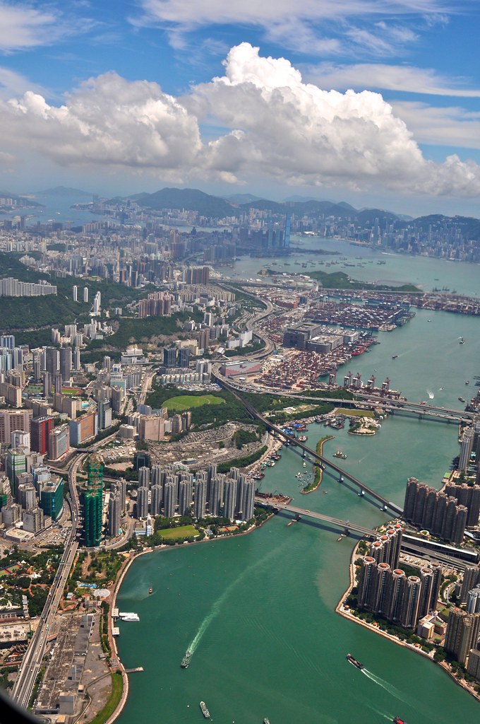
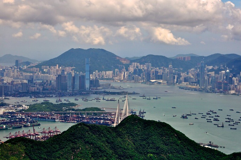
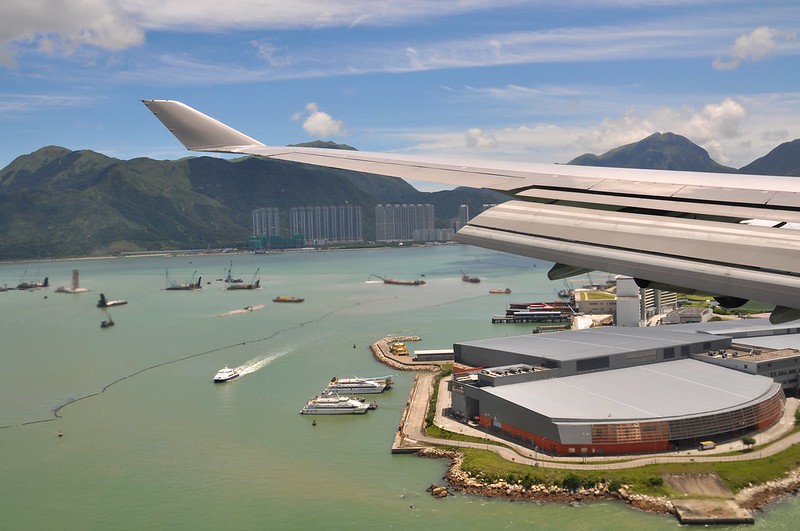
Part of the approach segment was through clouds, but the overall view was excellent. We enjoyed a great aerial tour of Hong Kong Island / Victoria Harbour / the Kowloon area from several different directions.
East side:

North side:
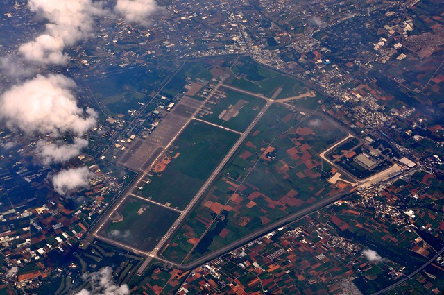
 That long strip in the middle is the old Kai Tak Airport.
West side:
After passing Kowloon, we also saw Disneyland,

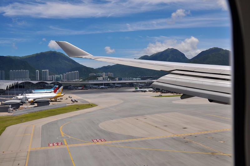
Before landing:
Passing the threshold of Runway 25R, altitude 50 feet:
Finally, a safe landing,

Hong Kong, the Pearl of the Orient, here I come!
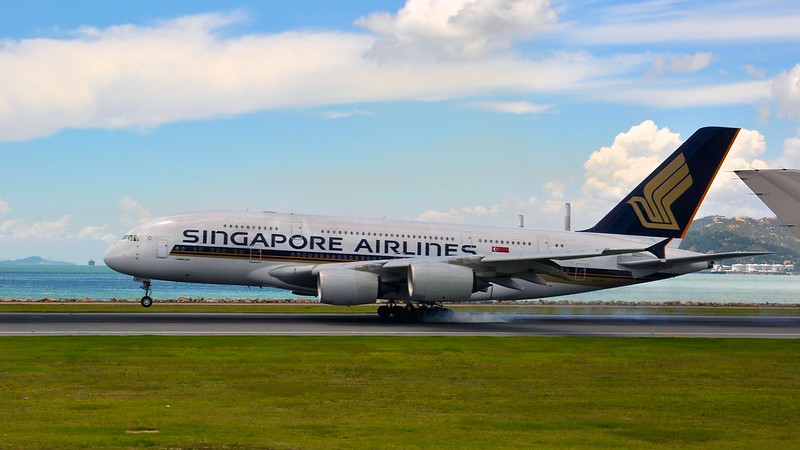
As the plane was taxiing on the taxiway, a Singapore Airlines A380 roared by. I immediately pressed the shutter and captured this moment just after it touched down.
Later, I simulated the flight route on the Jeppesen charts iPad app,
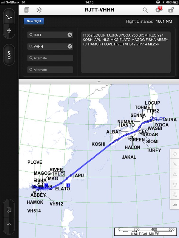 “TT052 LOCUP TAURA JYOGA Y56 SIOMI KEC Y24 KOSHI APU HLG MKG ELATO MAGOG FISHA ABBEY TD PEBEL RIVER VH512 VH514 ML25R "
When I have time, I’ll try flying this in X-Plane.
“TT052 LOCUP TAURA JYOGA Y56 SIOMI KEC Y24 KOSHI APU HLG MKG ELATO MAGOG FISHA ABBEY TD PEBEL RIVER VH512 VH514 ML25R "
When I have time, I’ll try flying this in X-Plane.
End