Free SkyVector Chart Website
Today, the flight chart website SkyVector has launched a worldwide charts service, and it’s free—truly a generous offering.
-thumb-640x507.png)
The service features a Google Maps-style interface with smooth zooming and panning operations.
It provides high and low-resolution IFR and VFR charts, as well as weather information for various airports.
It also includes a simple flight planning feature; after entering various Waypoints and speeds, it can automatically calculate flight distance and time. Although the functionality isn’t extremely powerful, it’s quite convenient as a reference.
-thumb-640x502.png)
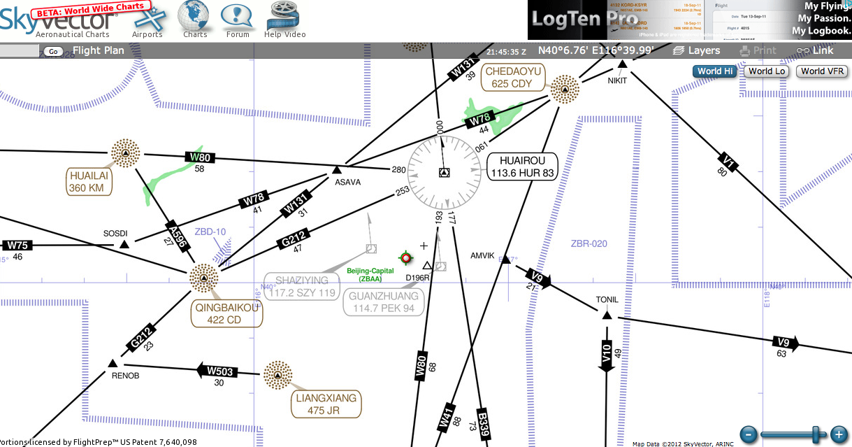
Looking at the high-altitude IFR enroute chart below, the airways in the sky are clear at a glance. In the future, before taking a flight, you can check the approximate route; this way, you’ll have a good idea of the areas the plane will fly over.

For how to query flight path information, please refer to the article Official Flight Path Query Methods Published by the ATMB.
The Complete China Charts provided by this site have also been updated to the 2017 2nd Edition. Welcome to use!!